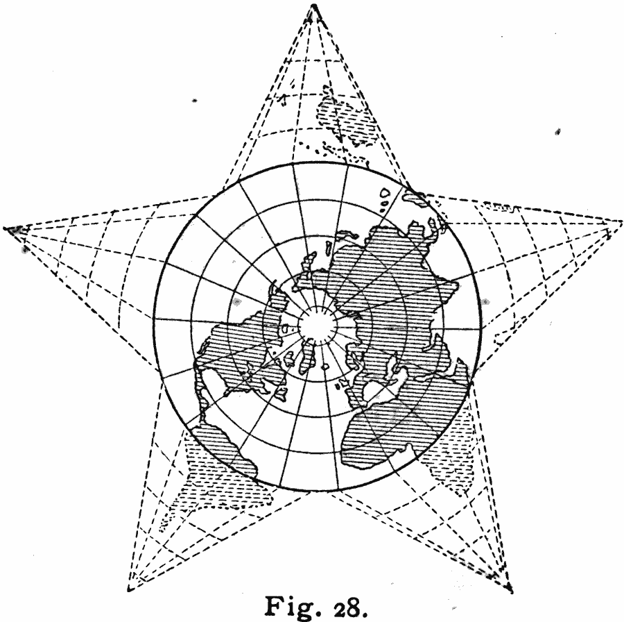
Description: A star-shaped map from 1909 showing the world on a polar projection. "In Polar Projection, the observer is supposed to be immediately over one of the poles of the earth, in the center of the map, and able to see at a glance the whole polar hemisphere from the pole to the equator (represented by the heavy circular line in the diagram). The parallels and the equator are indicated by concentric circles, and the meridians by straight lines radiating from the pole to the equator. This projection is especially adapted to show the true relative positions of features on opposite sides of the same polar hemisphere. The two polar hemispheres may be separately shown in two circles having the north and south poles respectively for their centers, and each terminating at the equator. [...] But when features to be compared are not entirely embraced in one polar hemisphere, the whole surface of the earth may be shown in this projection, by dividing the concealed hemisphere into any number of equal sectors, extending from the equator to the pole, and arranging these as points around the equator." — Hinman, 1909, p.54.
Place Names: A Complete Map of Globes and Multi-continent, Africa, �Asia, �Australia, �Europe, �North America, �South Americ
ISO Topic Categories: inlandWaters,
location,
oceans
Keywords: Polar Projection of the World, physical, kMapProjection, physical features, inlandWaters,
location,
oceans, Unknown, 1909
Source: Russell Hinman, Eclectic Physical Geography (Cincinnati, Ohio: Houghton Mifflin Company, 1888) 54
Map Credit: Courtesy the private collection of Roy Winkelman |
|