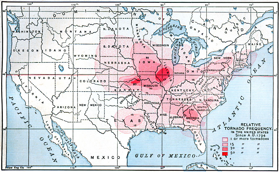
Description: A map from 1888 of the United States showing the relative frequency of tornadoes, and is color–coded to show frequency ranging from 1 or more to 50 or more tornadoes per year.
Place Names: Meteorology, tornad
ISO Topic Categories: climatologyMeteorologyAtmosphere,
oceans,
location,
inlandWaters
Keywords: Relative Tornado Frequency in the United States, physical, �meteorological, kClimate, physical features, climate, climatologyMeteorologyAtmosphere,
oceans,
location,
inlandWaters, Unknown, 1888
Source: Russell Hinman, Eclectic Physical Geography (Cincinnati, OH: Houghton Mifflin Company, 1888) 98
Map Credit: Courtesy the private collection of Roy Winkelman |
|