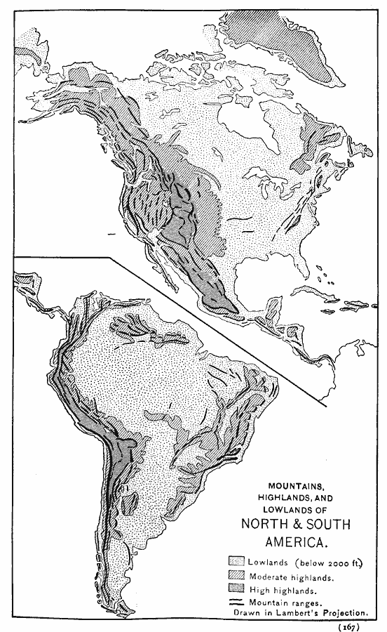
Description: A map of the continents of the western hemisphere from 1888. This map is drawn on a Lambert's Projection, and shows the general land elevations of the continents, with lowlands below 2000 feet in light gray, moderate and high highlands in darker shades, and mountain ranges shown with heavy black lines.
Place Names: Regional Americas, North America, �South Americ
ISO Topic Categories: physical, kWorldAmericas
Keywords: Mountains, Highlands, and Lowlands of the Western Hemisphere, physical, physical features, physical, kWorldAmericas, Unknown, 1888
Source: Russell Hinman, Eclectic Physical Geography (Cincinnati, OH: Houghton Mifflin Company, 1888) 167
Map Credit: Courtesy the private collection of Roy Winkelman |
|