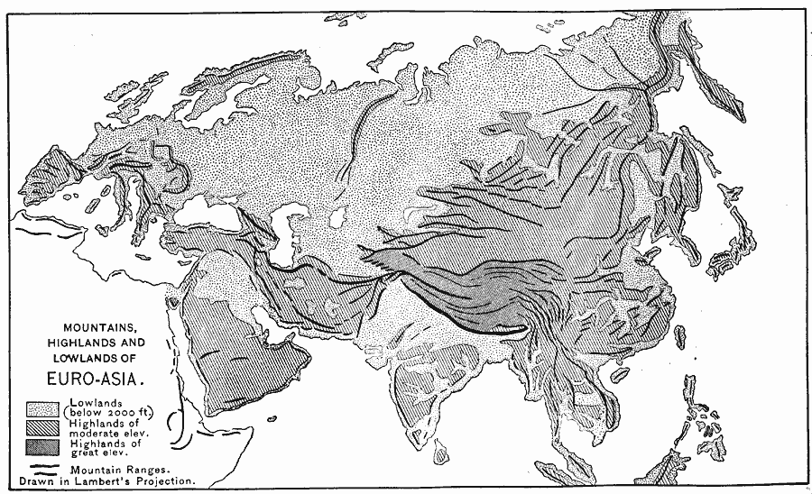
Description: A base map of Eurasia on a Lambert's projection from 1888, showing lowlands, highlands and mountain ranges. This map is shaded to show lowlands below 2000 feet above sea level in light gray, highlands of moderate elevation in medium gray, highlands of great elevation in dark gray, and mountain ranges shown by heavy black lines.
Place Names: Regional EurAsia, Europe, �Asi
ISO Topic Categories: physical, kWorldEurasia
Keywords: Mountains, Highlands, and Lowlands of Euro-Asia, physical, physical features, physical, kWorldEurasia, Unknown, 1888
Source: Russell Hinman, Eclectic Physical Geography (Cincinnati, Ohio: Houghton Mifflin Company, 1888) 173
Map Credit: Courtesy the private collection of Roy Winkelman |
|