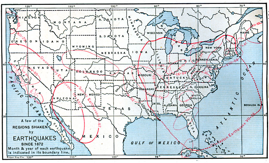
Description: A map from 1888 of the United States showing the regions shaken by earthquakes since 1872 and the extent of the area in which the earthquake was felt. The month and year of each earthquake is indicated in its boundary line.
Place Names: A Complete Map of the United States, earthquak
ISO Topic Categories: geoscientificInformation,
inlandWaters,
location,
oceans
Keywords: Earthquake Activity in the United States, physical, physical features, geoscientificInformation,
inlandWaters,
location,
oceans, Unknown, 1872–1882
Source: Russell Hinman, Eclectic Physical Geography (Cincinnati, OH: Houghton Mifflin Company, 1888) 267
Map Credit: Courtesy the private collection of Roy Winkelman |
|