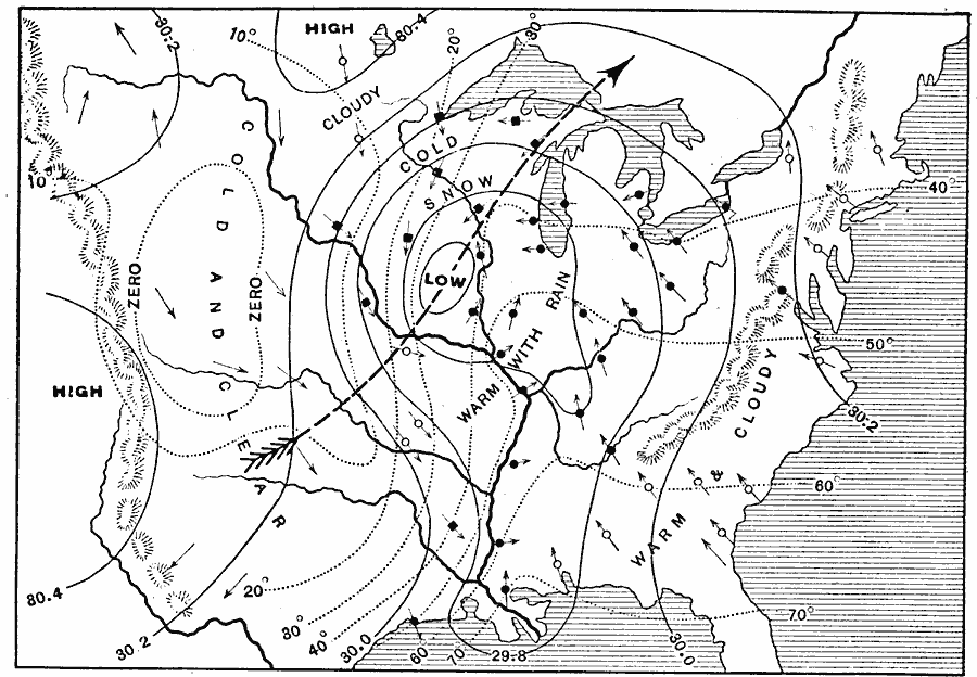
Description: A weather map from 1888 of the eastern United States showing a typical weather pattern from a November observation of a cyclone and low pressure system in Iowa as well as associated isobar and isotherm readings and wind directions. The map also shows rainfall, snow, and cloud coverage.
Place Names: Meteorology, Iowa, �Lake Erie, �Lake Michigan, �Texas, �temperature, �rainfall, �snow, �cloudiness, �cloud coverage, �barometric pressur
ISO Topic Categories: climatologyMeteorologyAtmosphere,
inlandWaters,
location,
oceans
Keywords: November Weather Map of Eastern United States, meteorological, kClimate, climate,
winds, climatologyMeteorologyAtmosphere,
inlandWaters,
location,
oceans, Unknown, 1888
Source: Russell Hinman, Eclectic Physical Geography (Cincinnati, OH: Houghton Mifflin Company, 1888) 296
Map Credit: Courtesy the private collection of Roy Winkelman |
|