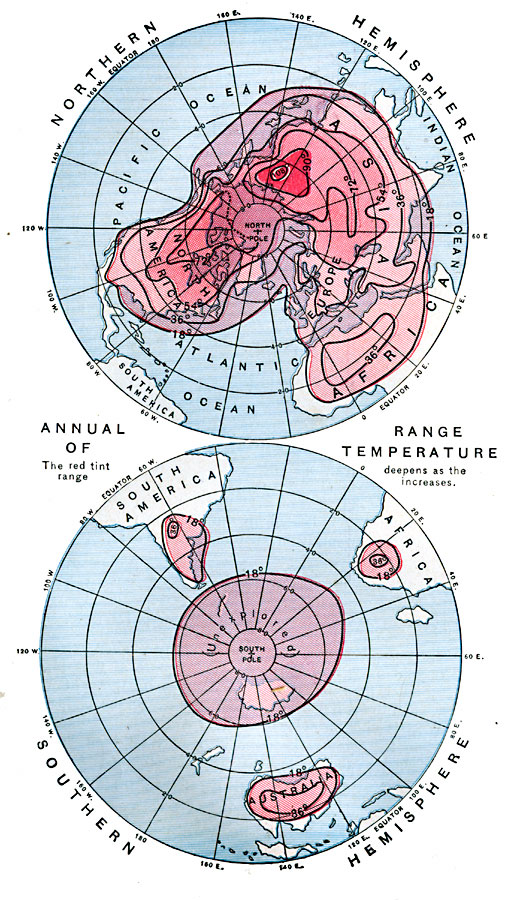
Description: A map from 1888 showing the northern and southern hemispheres at a polar projection. The map shows the annual range of mean temperature in each hemisphere. The map is color–coded to show areas of temperature ranges measures in degrees Fahrenheit, with the red tint deepening as the range increases. — Eclectic Physical Geography, 1888.
Place Names: A Complete Map of Globes and Multi-continent, Africa, �Antarctica, �Asia, �Australia, �Europe, �North America, �South Americ
ISO Topic Categories: climatologyMeteorologyAtmosphere,
location,
oceans
Keywords: World Annual Range of Temperature, meteorological, kClimate, temperature, climatologyMeteorologyAtmosphere,
location,
oceans, Unknown, 1888
Source: Russell Hinman, Eclectic Physical Geography (Cincinnati, Ohio: Houghton Mifflin Company, 1888) 300
Map Credit: Courtesy the private collection of Roy Winkelman |
|