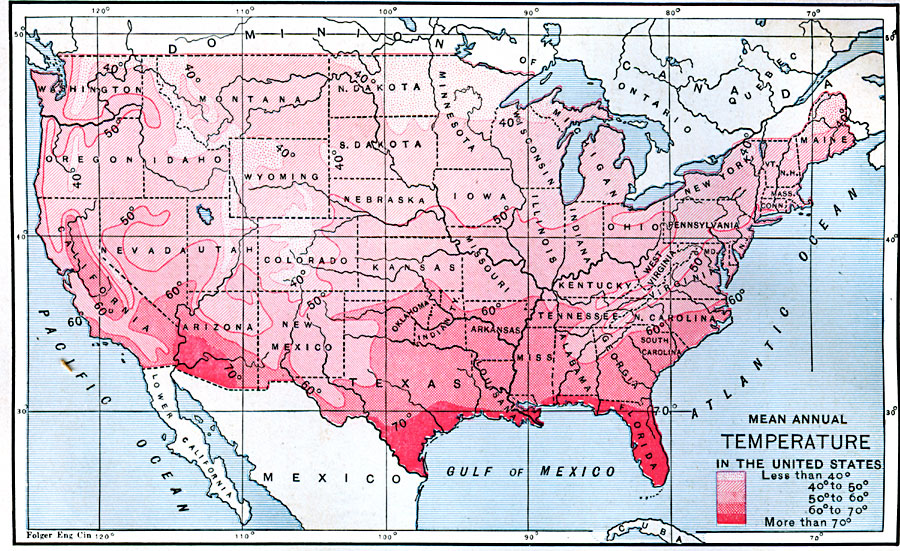
Description: A map from 1888 of the United States showing the mean annual temperatures for the region, given in degrees Fahrenheit. The map is color–coded to show averaged temperatures ranging from less than 40° to more than 70°.
Place Names: Meteorology, temperatur
ISO Topic Categories: climatologyMeteorologyAtmosphere,
inlandWaters,
location,
oceans
Keywords: Mean Annual Temperature in the United States, physical, �meteorological, kClimate, physical features, temperature, climatologyMeteorologyAtmosphere,
inlandWaters,
location,
oceans, Unknown, 1888
Source: Russell Hinman, Eclectic Physical Geography (Cincinnati, OH: Houghton Mifflin Company, 1888) 309
Map Credit: Courtesy the private collection of Roy Winkelman |
|