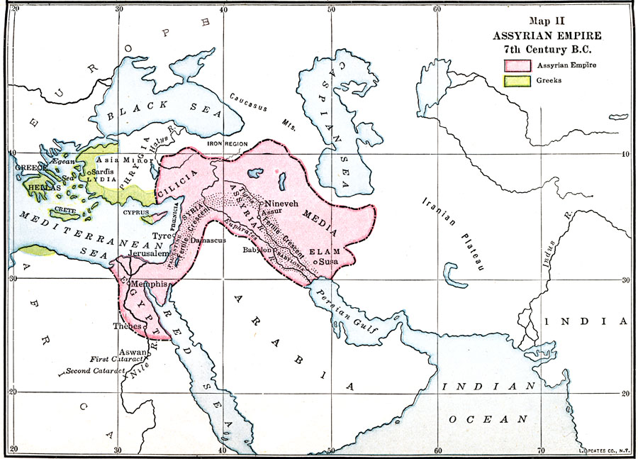
Description: A map of the Assyrian Empire in the 7th Century BC. The map is color–coded to show the extent of the Assyrian Empire at the time, and the independent Greek territories of Hellas.
Place Names: Regional Miscellaneous, Assyria, �Cilicia, �Damascus, �Egypt, �Elam, �Media, �Memphis, �Sinai, �Thebe
ISO Topic Categories: borders, �physical, kWorldMedSea, kWorldAfroAsia, kWorldEurasia
Keywords: Assyrian Empire, borders, �physical, borders, �physical, kWorldMedSea, kWorldAfroAsia, kWorldEurasia, Unknown, 7th Century BCE
Source: James Henry Breasted, Ph.D., LL.D., Ancient Times - A History of the Early World (Boston, MA: Ginn and Company, 1916)
Map Credit: Courtesy the private collection of Roy Winkelman |
|