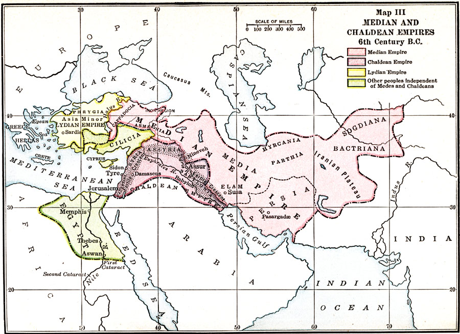
Description: A map of the Asian and Egyptian region showing the Median and Chaldean Empires in the 6th Century BC. The map is color–coded to show the Median, Chaldean, and Lydian Empires, and the independent empires at the time, including the Egyptians and Cilicia.
Place Names: Regional Miscellaneous, Elam, �Hyrcania, �Media, �Nineveh, �Parthia, �Persi
ISO Topic Categories: borders, �physical, kWorldMedSea, kWorldAfroAsia, kWorldEurasia
Keywords: Median and Chaldean Empires, borders, �physical, borders, �physical, kWorldMedSea, kWorldAfroAsia, kWorldEurasia, Unknown, 6th Century BCE
Source: James Henry Breasted, Ph.D., LL.D., Ancient Times - A History of the Early World (Boston, MA: Ginn and Company, 1916)
Map Credit: Courtesy the private collection of Roy Winkelman |
|