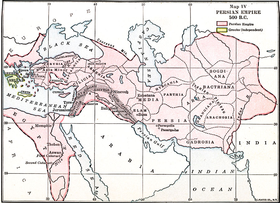
Description: A map of the Persian Empire in 500 BC, color–coded to distinguish between the Persian Empire and the independent Greek territories of Hellas.
Place Names: Regional Miscellaneous, Armenia, �Assyria, �Bablyon, �Cyprus, �Egypt, �Elam, �Iran, �Lydia, �Nineveh, �Persia, �Siam, �Thebe
ISO Topic Categories: borders, �physical, kWorldMedSea, kWorldAfroAsia, kWorldEurasia
Keywords: Persian Empire, borders, �physical, borders, �physical, kWorldMedSea, kWorldAfroAsia, kWorldEurasia, Unknown, 500 BCE
Source: James Henry Breasted, Ph.D., LL.D., Ancient Times - A History of the Early World (Boston, MA: Ginn and Company, 1916)
Map Credit: Courtesy the private collection of Roy Winkelman |
|