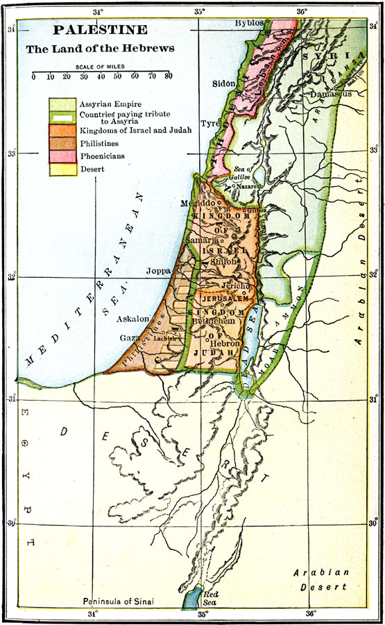
Description: A map of Palestine, subtitled "The Land of the Hebrews," color–coded to distinguish between the Assyrian Empire, Kingdoms of Israel and Judah, Philistines, Phoenicians, and the desert.
Place Names: Palestine, Assyria, �Bethlehem, �Damascus, �Gaza, �Israel, �Jerusalem, �Judah, �Phoenecia, �Shiloh, �Syri
ISO Topic Categories: oceans,
location,
inlandWaters
Keywords: Palestine, borders, �physical, �political, country borders, oceans,
location,
inlandWaters, Unknown, 500 BC
Source: James Henry Breasted, Ph.D., LL.D., Ancient Times - A History of the Early World (Boston, MA: Ginn and Company, 1916)
Map Credit: Courtesy the private collection of Roy Winkelman |
|