mapsMaps ETC Site map
 Maps ETC > Europe > Southeastern Europe > Western Limits of the Persian Empire and the Greek States in the Persian Wars, 490–479 B.C.
Site Map 

Western Limits of the Persian Empire and the Greek States in the Persian Wars, 490–479 B.C.

Western Limits of the Persian Empire and the Greek States in the Persian Wars


Title: Western Limits of the Persian Empire and the Greek States in the Persian Wars
Projection: Unknown,
Source Bounding Coordinates:
W: 20 E: 40 N: 40 S: 20

Main Map Page
Zoomify Version
B/W PDF Version
Color PDF Version
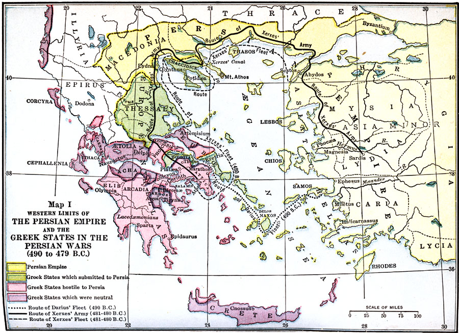
Description: A map of Western Limits of the Persian Empire and the Greek States in the Persian Wars (490–479 B.C.), color–coded to distinguish between the Persian Empire and Greek states.
Place Names: Southeastern Europe, Assyria, Crete, Cyprus, Damascus, Israel, Jerusalem, Memphis,
ISO Topic Categories: oceans, location, inlandWaters
Keywords: Western Limits of the Persian Empire and the Greek States in the Persian Wars, borders, physical, oceans, location, inlandWaters, Unknown, 490–479 B.C.
Source: James Henry Breasted, Ph.D., LL.D., Ancient Times - A History of the Early World (Boston, MA: Ginn and Company, 1916)
Map Credit: Courtesy the private collection of Roy Winkelman
SearchLicensePDF HelpGIS Help Google Earth Help Zoomify Help

 Maps ETC > Europe > Southeastern Europe > Western Limits of the Persian Empire and the Greek States in the Persian Wars, 490–479 B.C.
Site Map