mapsMaps ETC Site map
 Maps ETC > Europe > Italy > Italy and adjacent lands before the supremacy of Rome, 200 B.C.
Site Map 

Italy and adjacent lands before the supremacy of Rome, 200 B.C.

Italy and adjacent lands before the supremacy of Rome


Title: Italy and adjacent lands before the supremacy of Rome
Projection: Unknown,
Source Bounding Coordinates:
W: 8 E: 18 N: 46 S: 36

Main Map Page
Zoomify Version
B/W PDF Version
Color PDF Version
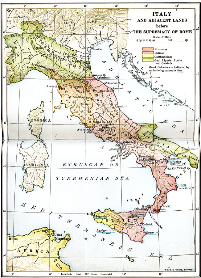
Description: Map of Italy and adjacent lands before the supremacy of Rome, color–coded to distinguish between Carthaginians, Etruscans, and Italians.
Place Names: Italy, Etruria, Greece, Italy, Liguria, Sicil
ISO Topic Categories: oceans, location, inlandWaters
Keywords: Italy and adjacent lands before the supremacy of Rome, borders, physical, oceans, location, inlandWaters, Unknown, 200 B.C.
Source: James Henry Breasted, Ph.D., LL.D., Ancient Times - A History of the Early World (Boston, MA: Ginn and Company, 1916)
Map Credit: Courtesy the private collection of Roy Winkelman
SearchLicensePDF HelpGIS Help Google Earth Help Zoomify Help

 Maps ETC > Europe > Italy > Italy and adjacent lands before the supremacy of Rome, 200 B.C.
Site Map