mapsMaps ETC Site map
 Maps ETC > Globes and Multi-continent > Regional Mediterranean > Expansion of Roman Empire from the Death of Caesar to the End of the Two Centuries of Peace, 44 B.C. to A.D. 167
Site Map 

Expansion of Roman Empire from the Death of Caesar to the End of the Two Centuries of Peace, 44 B.C. to A.D. 167

Expansion of Roman Empire from the Death of Caesar to the End of the Two Centuries of Peace


Title: Expansion of Roman Empire from the Death of Caesar to the End of the Two Centuries of Peace
Projection: Unknown,
Source Bounding Coordinates:
W: -10 E: 60 N: 50 S: 30

Main Map Page
Zoomify Version
B/W PDF Version
Color PDF Version
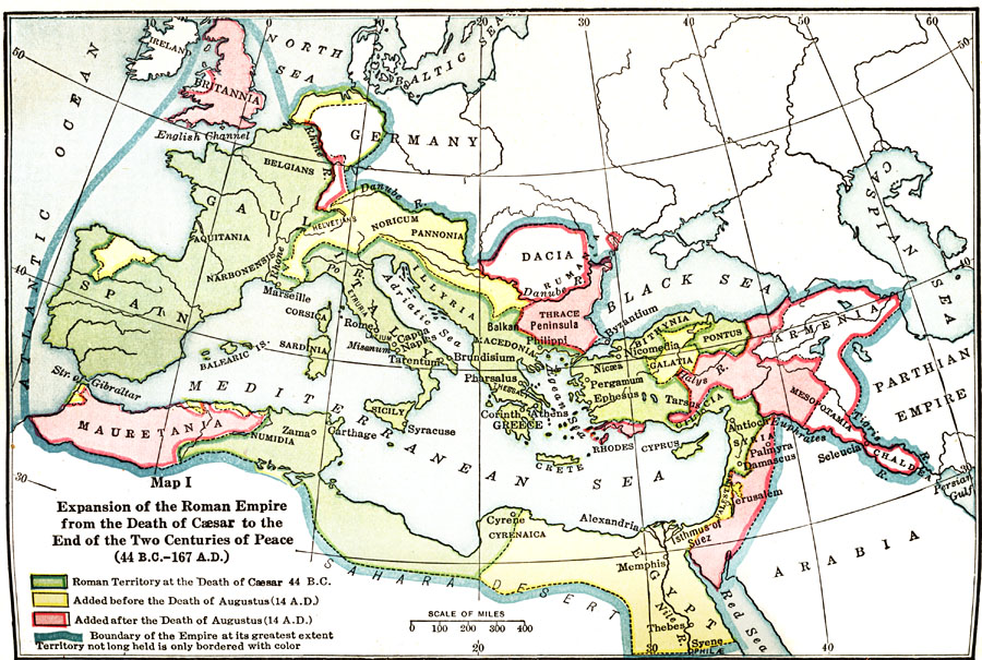
Description: Map showing the expansion of Roman power before the beginning of the Revolution to the Death of Caesar (133–44 B.C.), color–coded to distinguish between territory at the death of Caesar, and before & after the death of Augustus in AD 14.
Place Names: Regional Mediterranean, Dalmatia, Egypt, Greece, Italy, Sicily, Spain,
ISO Topic Categories: borders, physical, kWorldMedSea
Keywords: Expansion of Roman Empire from the Death of Caesar to the End of the Two Centuries of Peace, borders, physical, borders, physical, kWorldMedSea, Unknown, 44 B.C. to A.D. 167
Source: James Henry Breasted, Ph.D., LL.D., Ancient Times - A History of the Early World (Boston, MA: Ginn and Company, 1916)
Map Credit: Courtesy the private collection of Roy Winkelman
SearchLicensePDF HelpGIS Help Google Earth Help Zoomify Help

 Maps ETC > Globes and Multi-continent > Regional Mediterranean > Expansion of Roman Empire from the Death of Caesar to the End of the Two Centuries of Peace, 44 B.C. to A.D. 167
Site Map