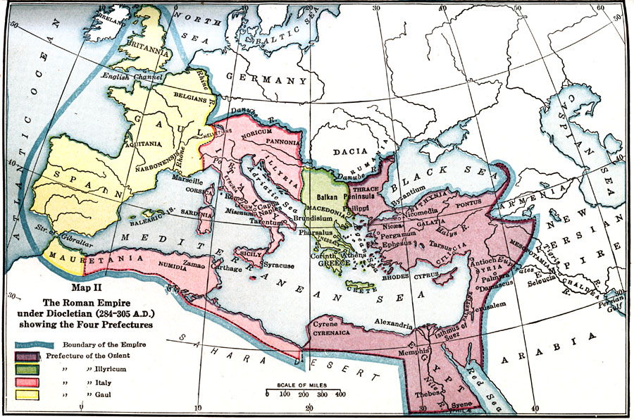
Description: Map showing the Roman Empire under Diocletian (AD 284–305) showing the Four Prefectures, color–coded to distinguish between the four prefectures.
Place Names: Regional Mediterranean, Egypt, �Greece, �Italy, �Mauritania, �Sicily, �Spain,
ISO Topic Categories: borders, �physical, kWorldMedSea, kWorldAfroAsia, kWorldEurasia, kWorldEuroAfrica
Keywords: The Roman Empire under Diocletian , borders, �physical, borders, �physical, kWorldMedSea, kWorldAfroAsia, kWorldEurasia, kWorldEuroAfrica, Unknown, AD 284–305
Source: James Henry Breasted, Ph.D., LL.D., Ancient Times - A History of the Early World (Boston, MA: Ginn and Company, 1916)
Map Credit: Courtesy the private collection of Roy Winkelman |
|