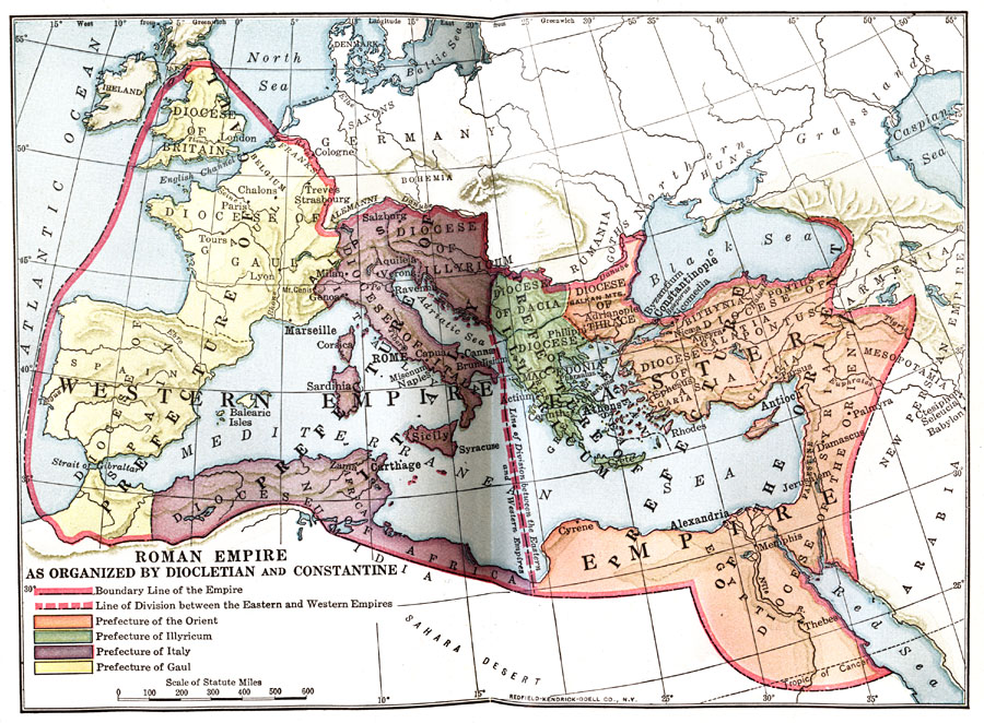
Description: Map showing the Roman Empire as organized by Diocletian and Constantine, color–coded to distinguish between the four prefectures of the Orient, Illyricum, Italy, and Gaul. Map also shows divisions between the eastern and western empires.
Place Names: Regional Mediterranean, Africa, �Asia, �Britain, �Egypt, �Europe, �Gaul, �Italy, �Macedonia, �Sicily, �Spai
ISO Topic Categories: borders, �physical, kWorldMedSea, kWorldAfroAsia, kWorldEurasia, kWorldEuroAfrica
Keywords: Roman Empire as organized by Diocletian and Constantine, borders, �physical, borders, �physical, kWorldMedSea, kWorldAfroAsia, kWorldEurasia, kWorldEuroAfrica, Unknown, Circa AD 395
Source: James Henry Breasted, Ph.D., LL.D., Ancient Times - A History of the Early World (Boston, MA: Ginn and Company, 1916)
Map Credit: Courtesy the private collection of Roy Winkelman |
|
