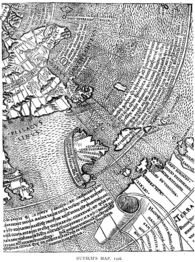
Description: It is the first engraved map with the discoveries of the New World delineated upon it. — Narrative and Critical History of America Vol. III, 1884
Place Names: Western Hemisphere, North America, �South America, �Atlantic Ocean,
ISO Topic Categories: oceans,
location,
inlandWaters
Keywords: Ruysch's Map, physical, physical features, oceans,
location,
inlandWaters, Unknown, 1508
Source: Justin Winsor, Narrative and Critical History of America Vol. III (Boston, Massachusetts: Houghton, Mifflin and Company, 1884)
Map Credit: Courtesy the private collection of Roy Winkelman |
|