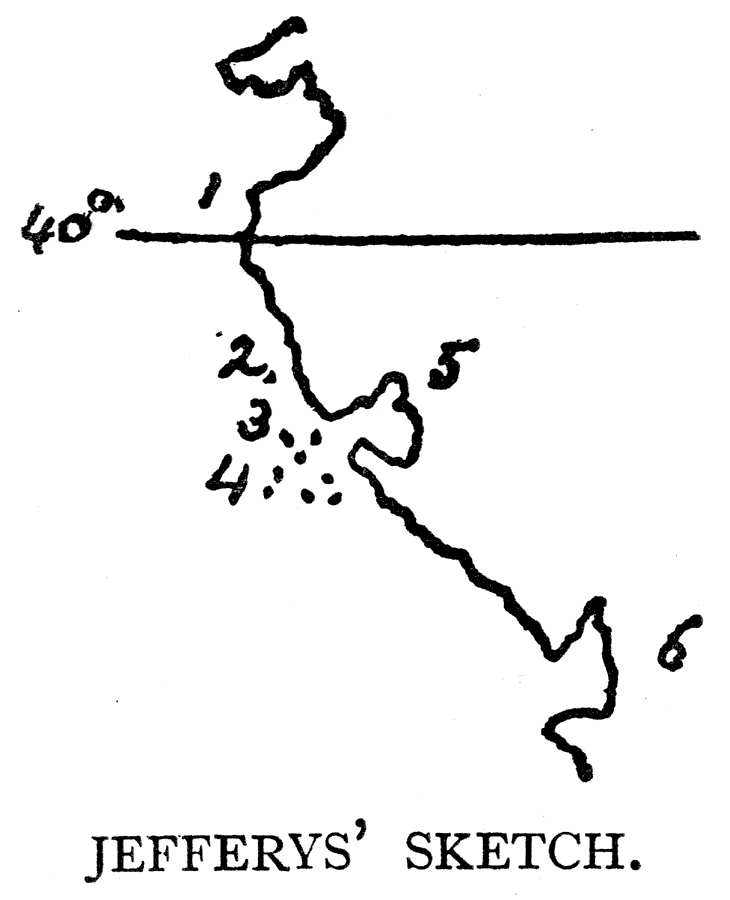
Description: A facsimile of a sketch map from Jeffery (1753) showing the explorations of Sir Francis Drake along the California coast. The map is keyed to show the locations of: (1) C. das Navadas, or Snowy Cape; (2) Punta de los Reys; (3) Les Farollones; (4) Isles of St. James; (5) Port Sr. Francis Drake, 1578, not St. Francisco; and (6) Pto. de Anno Novo. — Narrative and Critical History of America Vol. III, 1884.
Place Names: California, New Albion, �Cape das Navadas, �Snowy Cape, �Punta de los Reys, �Les Farollones, �Isles of St. James, �Port Sr. Francis Drake, �Pto. de Anno Novo
ISO Topic Categories: location
Keywords: Jefferys' Sketch of New Albion, physical, kEarlyMapsFacsimile, physical features, location, Unknown, 1753
Source: Justin Winsor, Narrative and Critical History of America Vol. III (Boston, MA: Houghton, Mifflin and Company, 1884) 77
Map Credit: Courtesy the private collection of Roy Winkelman |
|