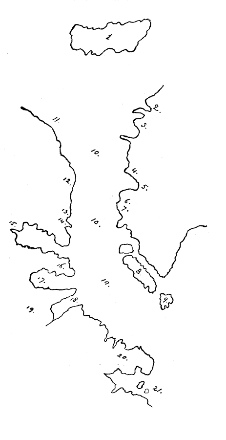
Description: Shows locations of : 1. Grocland. 2. Hope Sanderson. 3. London cost. 4. Marchant Yle. 5. Davies island. 6. Challer's Cape. 7. Gilbert's Sound. 8. Easter Point. 9. Regin. Eli. forland. 10. Fretum Davis. 11. Mare Conglelatum. 12. C. Bedford. 13. Sandrson's tour. 14. Mont Ralegh. 15. E. Cumberland isles. 16. E Warwicke's forland. 17 L. Lumley's inlet. 18. A furious overfall. 19. Terre de Labrador. 20. Dorgeo. 21. I. de Arel. — Narrative and Critical History of America Vol. III, 1884
Place Names: A Regional Map of North America, Greenland, �Grocland, �Hope Sanderson, �Gilbert's Sound, �Easter Point, �Davies Island, �Challer's Cape, �C. Bedford, ��Canad
ISO Topic Categories: location
Keywords: Northeastern North America, physical, physical features, location, Unknown, 1592
Source: Justin Winsor, Narrative and Critical History of America Vol. III (Boston, MA: Houghton, Mifflin and Company, 1884) 90
Map Credit: Courtesy the private collection of Roy Winkelman |
|