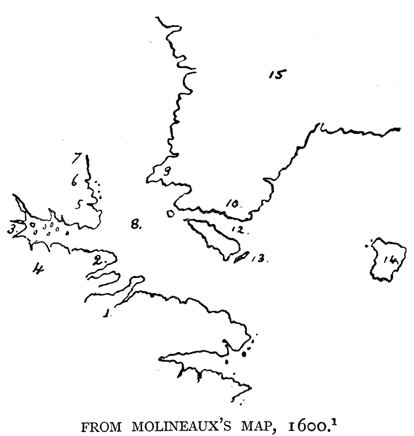
Description: Shows locations of: 1. A furious overfall. 2. Warwick's forelande. 3. E. Cumberland Inlet. 4. Estotiland. 5. M. Rawghley. 6. Saunderson's towe. 7. C. Bedford. 8. Fretum Davis. 9. Desolation. 10. Warwick's Forlande. 11. Meta incognita. 12. Mr. Forbusher's straights. 13. Reg. E. Foreland. 14. Freyland. 15. Gronlande. — Narrative and Critical History of America Vol. III, 1884
Place Names: A Regional Map of North America, Gronlande, �Sanderson's towe., �C. Bedford, �Estotiland, �M. Raqghley, �Fretum Davis, �Warwick's Forlande, �Freyland, ��Canad
ISO Topic Categories: location
Keywords: Northeastern North America, physical, physical features, location, Unknown, 1600
Source: Justin Winsor, Narrative and Critical History of America Vol. III (Boston, MA: Houghton, Mifflin and Company, 1884) 91
Map Credit: Courtesy the private collection of Roy Winkelman |
|