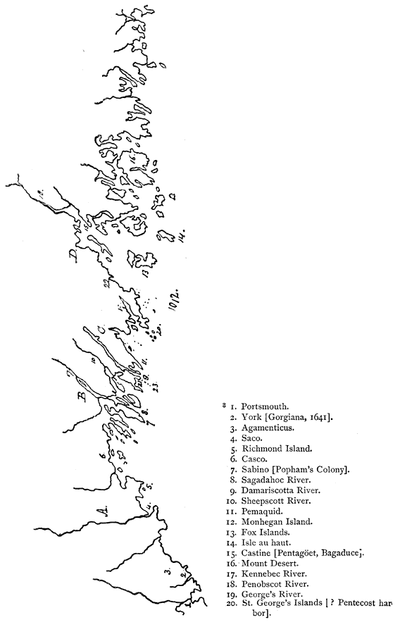
Description: A sketch map from 1884 of the Maine coastline showing early settlements, and is keyed to show: Shows locations of: (1) Portsmouth; (2) York (Gorgiana, 1641); (3) Agamenticus; (4) Saco; (5) Richmond Island; (6) Casco; (7) Sabino (Popham's Colony); (8) Sagadahoc River; (9) Damariscotta River; (10) Sheepscott River; (11) Pemaquid; (12) Monhegan Island; (13) Fox Islands; (14) Isle as haut; (15) castine (Pentagoet, Bagaduce); (16) Mount Desert; (17) Kennebec River; (18) Penobscot River: (19) George's River; (20) St. George's Islands (? Pentobscot harbor); (21) Boothbay (? Pentecost); (22) Camden Hills; (23) Damariscove Islands; (A) Lygonia, 1630, subsequently part of Gorges and Mason's grant, 1622, and Somersetshire, 1635; (B) Plymouth grant; (C) Muscongus, 1630; and (D) Waldo patent. — Narrative and Critical History of America Vol. III, 1884.
Place Names: Maine, Portsmouth, �York, �Agamenticus, �Saco, �Richmond Island, �Casco, �Sabino, �Sagadahoc River, �Damariscotta River, �Sheepscott River, �Pemaquid,
ISO Topic Categories: inlandWaters,
location
Keywords: Coast of Maine, physical, physical features, inlandWaters,
location, Unknown, 1884
Source: Justin Winsor, Narrative and Critical History of America Vol. III (Boston, MA: Houghton, Mifflin and Company, 1884) 190
Map Credit: Courtesy the private collection of Roy Winkelman |
|