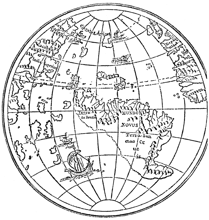
Description: A small copper globe in the Lenox Library, in New York, which is said to be the earliest globe to show the American coast, and its date is fixed at about 1510–12, but some as early as 1506–7. — Narrative and Critical History of America Vol. III, 1884
Place Names: Western Hemisphere, North America, �South Americ
ISO Topic Categories: inlandWaters,
location,
oceans
Keywords: New World From Lenox Globe, physical, physical features, inlandWaters,
location,
oceans, Unknown, 1500–1515
Source: Justin Winsor, Narrative and Critical History of America Vol. III (Boston, Massachusetts: Houghton, Mifflin and Company, 1884) 212
Map Credit: Courtesy the private collection of Roy Winkelman |
|