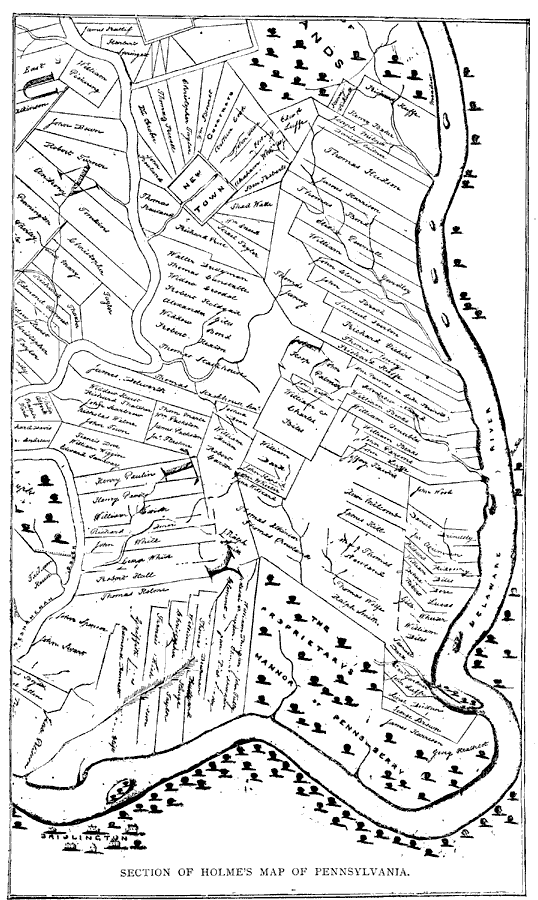
Description: A portion of a map from 1681 by Thomas Holme, Surveyor–General, showing the vicinity of Newtown, Pennsylvania, in Bucks County. The map shows the Delaware River and Neshaminy Creek, the proposed New Town, and property lines. "This is the most important of all the early maps issued shortly after 1681. It contains the names of many of the early settlers, and shows Penn's idea of settling the country. In some cases the lots front on a square, which it is presumed was dedicated to public uses. This feature is still noticeable in one or two of the original settlements." — Winsor, 1884, p. 516.
Place Names: Pennsylvania, Delaware River,
ISO Topic Categories: boundaries,
inlandWaters,
location
Keywords: Section of Holme's Map of Pennsylvania, physical, physical features, boundaries,
inlandWaters,
location, Unknown, 1681
Source: Justin Winsor, Narrative and Critical History of America Vol. III (Boston, MA: Houghton, Mifflin and Company, 1884)
Map Credit: Courtesy the private collection of Roy Winkelman |
|
