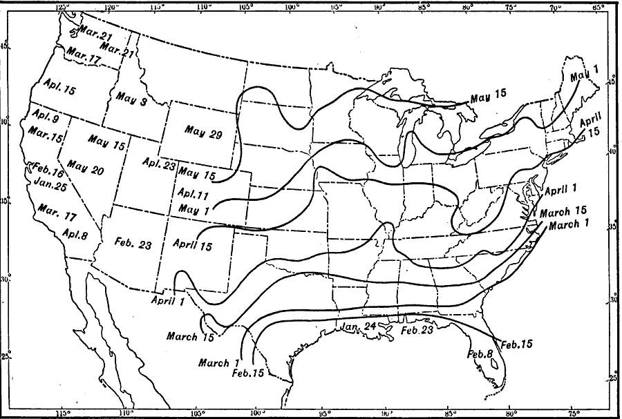
Description: A map from 1911 of the United States showing the isolines of the average last killing frost in Spring with typical dates given, and local variations in the Pacific and intermountain regions.
Place Names: Meteorology, fros
ISO Topic Categories: climatologyMeteorologyAtmosphere,
location,
oceans,
inlandWaters
Keywords: Last Killing Frost of Spring, physical, �political, �meteorological, kClimate, physical features, country borders,
major political subdivisions, climate, climatologyMeteorologyAtmosphere,
location,
oceans,
inlandWaters, Unknown, 1911
Source: Isaiah Bowman, Ph. D., Forest Physiography (New York, NY: John Wiley and Sons, 1911) 116
Map Credit: Courtesy the private collection of Roy Winkelman |
|