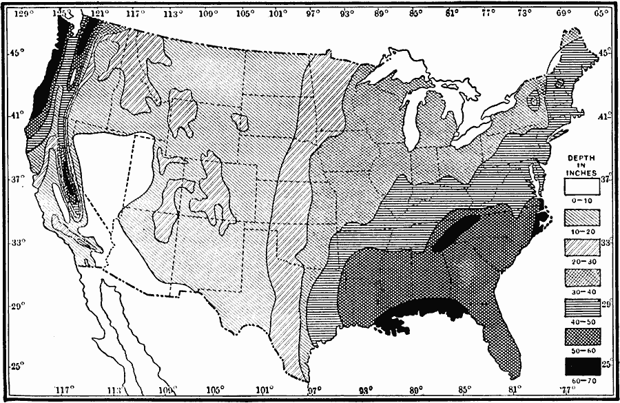
Description: A map from 1911 of the United States showing the mean annual precipitation. Because precipitation includes snowfall, the measurements are reduced to equivalent measure of rainfall given in inches. This map shows the coastal and mountain effect on rainfall distribution in the Pacific Northwest and Gulf region. The map also clearly shows the ‘100th Meridian’ in the Great Plains, a line of longitude that generally marks the furthest reaches of moist Gulf air, and delineates the moist east and arid west.
Place Names: Meteorology, precipitatio
ISO Topic Categories: climatologyMeteorologyAtmosphere,
inlandWaters,
location,
oceans
Keywords: Mean Annual Precipitation in the United States, physical, �political, �meteorological, kClimate, kPrecipitation, physical features, country borders,
major political subdivisions, rainfall, climatologyMeteorologyAtmosphere,
inlandWaters,
location,
oceans, Unknown, 1911
Source: Isaiah Bowman, Ph. D., Forest Physiography (New York, NY: John Wiley and Sons, 1911) 118
Map Credit: Courtesy the private collection of Roy Winkelman |
|