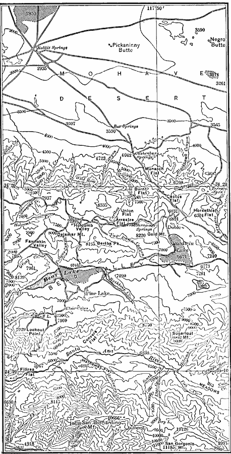
Description: A map of a portion of the San Bernardino Mountains near Big Bear Lake in 1911. The map is based on the USGS San Gorgonio quadrangle, with contour intervals of 500 feet. "Bear Valley and the adjacent country exhibit the subdued relief characteristic of the interior of the San Bernardino Mountains. The parallel of 34° 20’ coincides with a fault scarp on the northern border of the range; the southern edge of the map represents a part of the southern border of similar origin. Both borders are deeply dissected. Note the withering streams, foreland plain, and playa of the Mojave desert." — Bowman, 1911, p. 137.
Place Names: California, Rabbit Springs, �Bear Valle
ISO Topic Categories: transportation,
location,
inlandWaters,
elevation
Keywords: Bear Valley Region, physical, �transportation, physical features, roads, transportation,
location,
inlandWaters,
elevation, Unknown, 1911
Source: Isaiah Bowman, Ph. D., Forest Physiography (New York, NY: John Wiley and Sons, 1911) 136
Map Credit: Courtesy the private collection of Roy Winkelman |
|