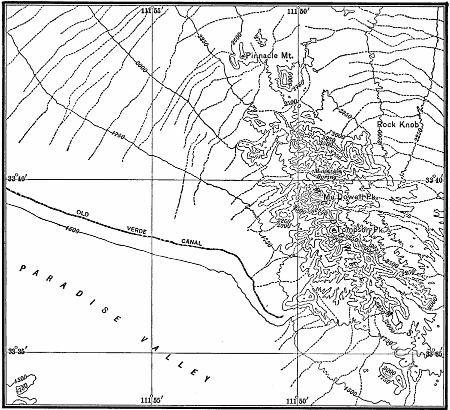
Description: A map from the U.S.Geological Survey Camelback quadrangle (1911) showing the waste–bordered mountains of the Arizona Highlands. The text notes the lack of a permanent stream, the large number of intermittent streams as shown by the dotted lines, and the ragged character of the mountain slopes. Contour intervals are 250 feet. — Bowman, 1911.
Place Names: Arizona,
ISO Topic Categories: elevation,
location,
inlandWaters
Keywords: Arizona Highlands, physical, topographical, elevation,
location,
inlandWaters, Unknown, 1911
Source: Isaiah Bowman, Ph. D., Forest Physiography (New York, NY: John Wiley and Sons, 1911) 248
Map Credit: Courtesy the private collection of Roy Winkelman |
|