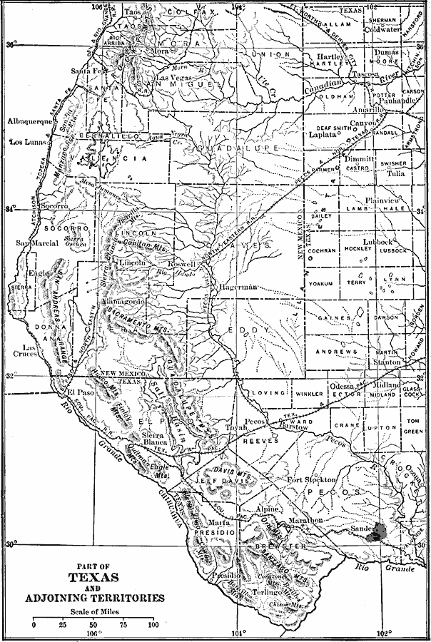
Description: The principal mountain ranges of the Trans-Pecos province, chief drainage features, and the bordering Llano Estacado.
Place Names: Southwestern States, New Mexico, �Texas, �Old Southwest, �New Southwes
ISO Topic Categories: boundaries,
inlandWaters,
location
Keywords: Part of West Texas and New Mexico, physical, �political, physical features, country borders,
major political subdivisions, drainage basins, boundaries,
inlandWaters,
location, Unknown, 1911
Source: Isaiah Bowman, Ph. D, Forest Physiography (New York, NY: John Wiley and Sons, 1911) 388
Map Credit: Courtesy the private collection of Roy Winkelman |
|