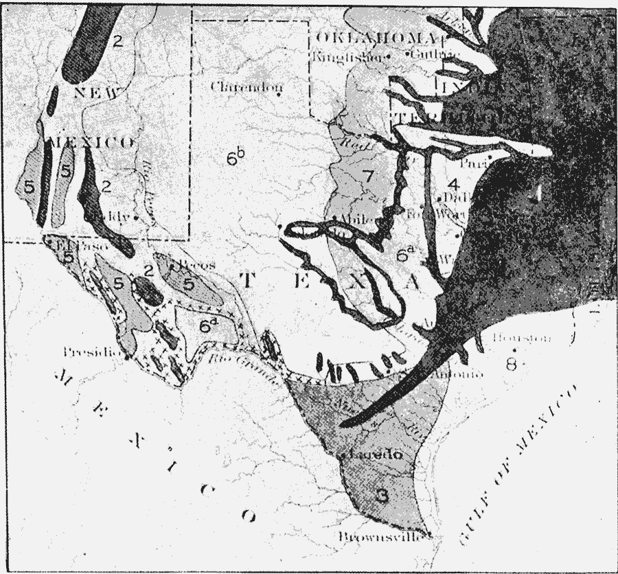
Description: A map showing the vegetation types of the Texas region. The map is keyed to show: (1) Atlantic forest belt; (2) Rocky Mountain forest; (3) Chaparral; (4) Black Prairie; (5) bolson desert flora; (6a) Grand Prairie; (6b) Great Plains; (7) transitional, with plains, prairie, and Atlantic flora; (8) coast prairies; and XXX, yucca belts.
Place Names: Texas, New Mexico, �Oklahoma, �Texa
ISO Topic Categories: boundaries,
inlandWaters,
location
Keywords: Vegetation of the Texas Region, physical, �statistical, �political, kBiodiversity, physical features, country borders,
major political subdivisions, vegetation, boundaries,
inlandWaters,
location, Unknown, 1911
Source: Isaiah Bowman, Ph. D, Forest Physiography (New York, NY: John Wiley and Sons, 1911) 426
Map Credit: Courtesy the private collection of Roy Winkelman |
|