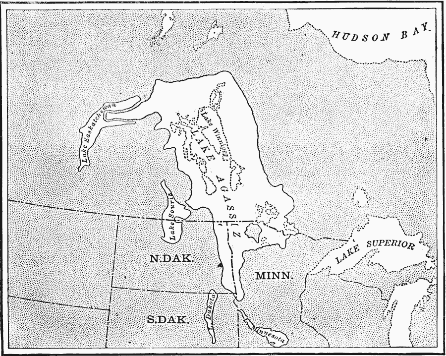
Description: A map of the Laurentide era glacial Lake Agassiz in the present day region of the northern United States and southern Saskatchewan, Manitoba, and Ontario. The lake was present during the last glacial period, and covers an area larger than the modern Great Lakes combined. The map shows the ancient shorelines of Lake Agassiz, Lake Saskatchewan, Lake Souris, Lake Dakota, and Lake Minnesota, and the present day shorelines of Lake Winnipeg, Lake Superior, and Lake Michigan.
Place Names: A Regional Map of North America, Canada, �United State
ISO Topic Categories: boundaries,
geoscientificInformation,
inlandWaters,
location
Keywords: Lake Agassiz, physical, �political, kGlacial, physical features, country borders,
major political subdivisions, boundaries,
geoscientificInformation,
inlandWaters,
location, Unknown, 1911
Source: Isaiah Bowman, Ph. D, Forest Physiography (New York, NY: John Wiley and Sons, 1911) 484
Map Credit: Courtesy the private collection of Roy Winkelman |
|