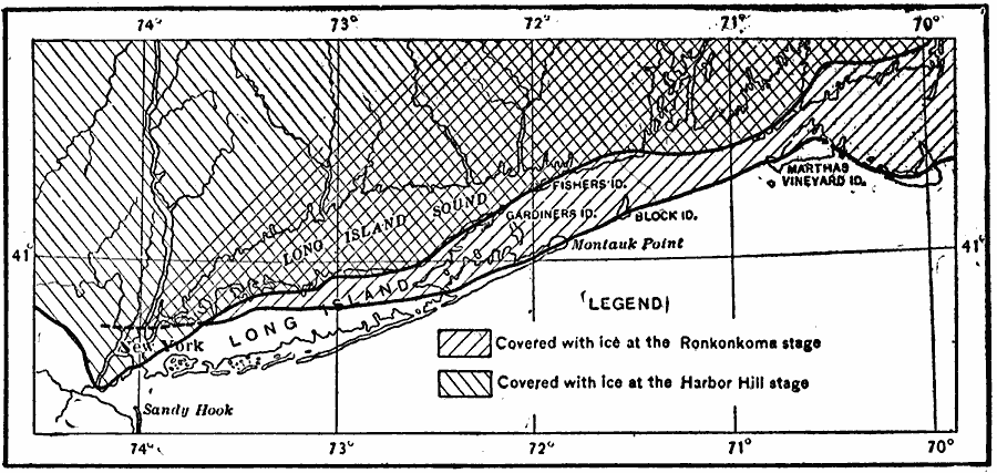
Description: A map from 1911 of Long Island showing the two stages of ice coverage during the Wisconsin glaciation. The map is keyed to show the extent of coverage during the Ronkonkoma stage and the Harbor Hill stage.
Place Names: New York, Long Island, �Martha's Vinyar
ISO Topic Categories: inlandWaters,
location,
boundaries,
geoscientificInformation
Keywords: Ice During the Wisconsin Glaciation, physical, kGlacial, physical features, inlandWaters,
location,
boundaries,
geoscientificInformation, Unknown, 1911
Source: Isaiah Bowman, Ph. D, Forest Physiography (New York, NY: John Wiley and Sons, 1911) 507
Map Credit: Courtesy the private collection of Roy Winkelman |
|