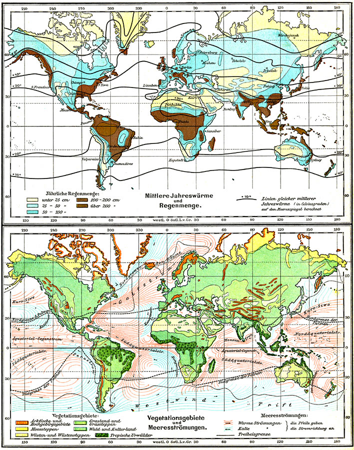
Description: Two German World maps from 1915 showing average temperature and rainfall distribution in the upper map and vegetation regimes and ocean currents in the lower map. The upper map is color–coded to show the mean annual rainfall given in centimeters with isotherms of mean temperatures given in degrees Celsius. The lower map is color–coded to show the vegetation regions and the warm and cold ocean currents.
Place Names: A Complete Map of Globes and Multi-continent, Africa, �Asia, �Australia, �Europe, �North America, �South America, �Gulfstream,�Westwind drif
ISO Topic Categories: geoscientificInformation,
biota,
climatologyMeteorologyAtmosphere,
environment,
oceans
Keywords: Average Temperature and Rainfall; Vegetation Regimes and Ocean Currents , physical, �meteorological, �hydrological, rainfall,
temperature, currents, geoscientificInformation,
biota,
climatologyMeteorologyAtmosphere,
environment,
oceans, Unknown, 1915
Source: C. Diercke, Lange-Diercke Volksschulatlas (Berlin, Germany: George Westermann, 1915) 6
Map Credit: Courtesy the private collection of Roy Winkelman |
|