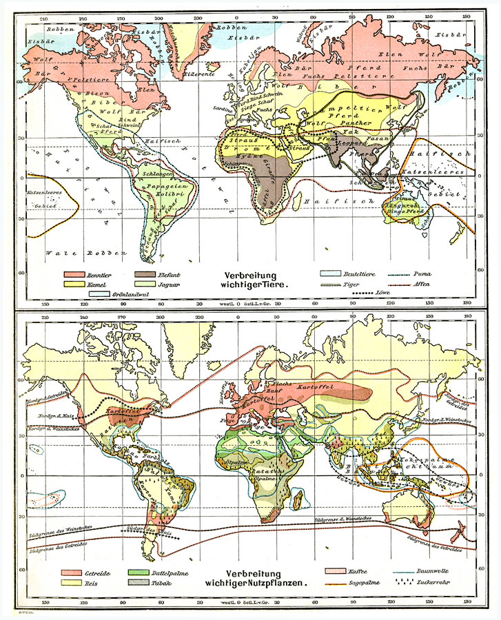
Description: Two German World maps from 1915 showing natural habitat regions for various "important" animals and useful plants. The upper map (wichtiger Tiere — important animals) is color–coded to show the regions of Renntier (Reindeer), Kamel (camel), Elefant (elephant), Jaguar, Grönlanwal (Greenland whale), Beuteltiere (marsupials), Puma, Tiger, Affen (apes), and Löwe (lions). Other animals are listed on the map. The lower map (wichtiger Nutzpflanzen — useful plants) is color–coded to show the regions of Getreide (cereal grains), Reis (rice), Dattelpalme (date palms), Tabäk (tobacco), Kaffee (coffee), Sagopalme (sago palms), Baumwolle (cotton), and Zuckerrohr (sugar cane). Other plant crops are listed on the map.
Place Names: A Complete Map of Globes and Multi-continent, Africa, �Asia, �Australia, �Europe, �North America, �Pacific Ocean, �South Americ
ISO Topic Categories: geoscientificInformation,
farming,
biota
Keywords: Important Animals and Major Crops of the World, physical, �statistical, physical features, agriculture,
vegetation, geoscientificInformation,
farming,
biota, Unknown, 1915
Source: C. Diercke, Lange-Diercke Volksschulatlas (Berlin, Germany: George Westermann, 1915) 7
Map Credit: Courtesy the private collection of Roy Winkelman |
|