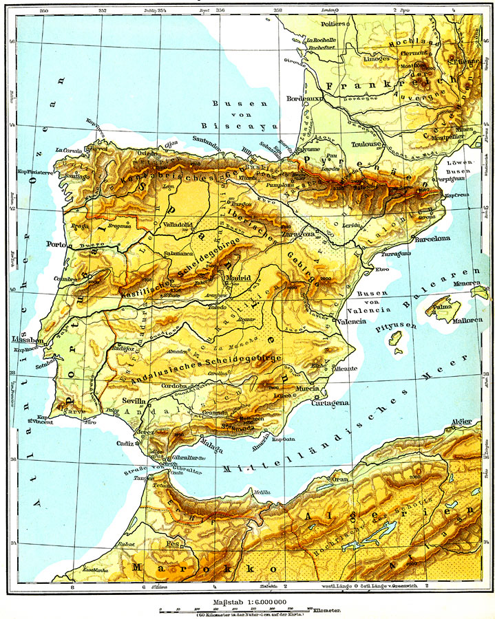
Description: A physical map of the Iberian Peninsula including Spain, Portugal, and Andorra. This map shows major cities (including cities with a population over one million), major rail lines, the major landforms (the Pyrenees, Cordillera Cantábrica, Meseta Central, Sistema Central, and Baetic Cordillera) and rivers (Duero, Tajo, and Ebro).
Place Names: Iberian Peninsula, Spain, �Portugal, �Andorra, �Barcelona, �Valencia, �Cartagena, �Lisbon, �Porto, �Madrid, �Bay of Biscay, �Mallorca, �Gibralter,
ISO Topic Categories: boundaries,
inlandWaters,
transportation,
elevation
Keywords: Iberian Peninsula, physical, �political, �transportation, physical features, country borders, railroads, boundaries,
inlandWaters,
transportation,
elevation, Unknown, 1915
Source: C. Diercke, Lange-Diercke Volksschulatlas (Berlin, Germany: George Westermann, 1915) 26
Map Credit: Courtesy the private collection of Roy Winkelman |
|