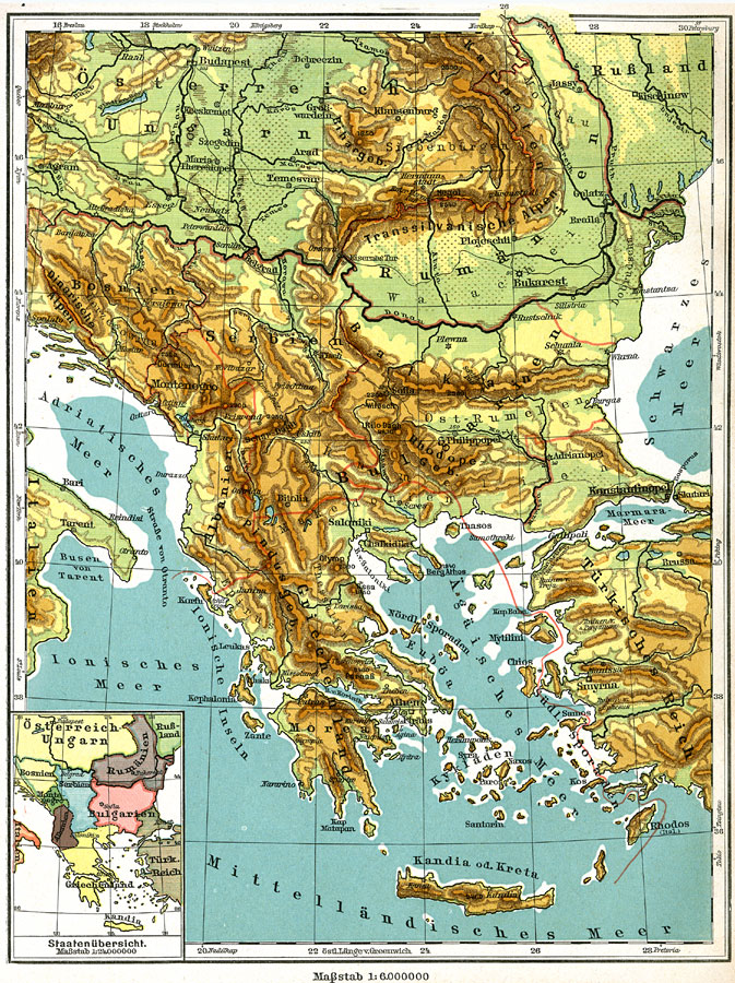
Description: A physical map of the Balkan Peninsula (Bosnia, Serbia, Montenegro, Albania, Macedonia, Bulgaria, and Greece) circa 1915 showing major cities (including cities with a population over one million), major landforms and waterways. Map has an inset showing the political boundaries of the peninsula.
Place Names: Southeastern Europe, Greece, �Romania, �Bosnia, Serbia, �Montenegro, �Albania, �Bulgaria, �Constantinople, �Cret
ISO Topic Categories: geoscientificInformation,
elevation,
boundaries
Keywords: Balkan Peninsula, physical, �political, �transportation, physical features, country borders, railroads, geoscientificInformation,
elevation,
boundaries, Unknown, 1915
Source: C. Diercke, Lange-Diercke Volksschulatlas (Berlin, Germany: George Westermann, 1915) 28
Map Credit: Courtesy the private collection of Roy Winkelman |
|