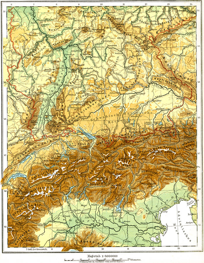
Description: Physical map of the southern German Empire circa 1915 showing Railroad lines, major landforms and waterways (including major canals). West/east area coverage is from Metz on the border with France to Salzburg in the east, and north/south area coverage is from Cologne/Dresden south to Northern Italy. Major landforms include the Alps, Dolomites, and Rhine Valley as well as the Danube, Rhine, and Main Rivers.
Place Names: Germany, Cologne, �Dresden, �Frankfurt am Main, �Mannheim, �Nuremberg, �Munich, �Stuttgart, �Ul
ISO Topic Categories: boundaries,
elevation,
inlandWaters
Keywords: Southern Germany (Physical), physical, �political, �transportation, physical features, country borders, railroads, boundaries,
elevation,
inlandWaters, Unknown, 1915
Source: C. Diercke, Lange-Diercke Volksschulatlas (Berlin, : George Westermann, 1915) 36
Map Credit: Courtesy the private collection of Roy Winkelman |
|