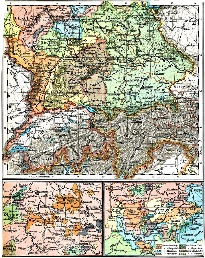
Description: Political map of the southern German Empire circa 1915 showing the southern States, and including the northern States of Braunschweig and Thüringishe. Switzerland and the western portion of the Austro–Hungarian Empire are also shown on this map.
Place Names: Germany, Frankfurt am Main, �Mannheim, �Nuremberg, �Wiesbaden, �Zurich, �Bern, �Salzburg, �Munic
ISO Topic Categories: boundaries,
inlandWaters
Keywords: Southern German States, Braunschwieg State, and Thüringische State, physical, �political, �transportation, physical features, country borders,
major political subdivisions,
local jurisdictions, railroads, boundaries,
inlandWaters, Unknown, 1915
Source: C. Diercke, Lange-Diercke Volksschulatlas (Berlin, : George Westermann, 1915) 37
Map Credit: Courtesy the private collection of Roy Winkelman |
|