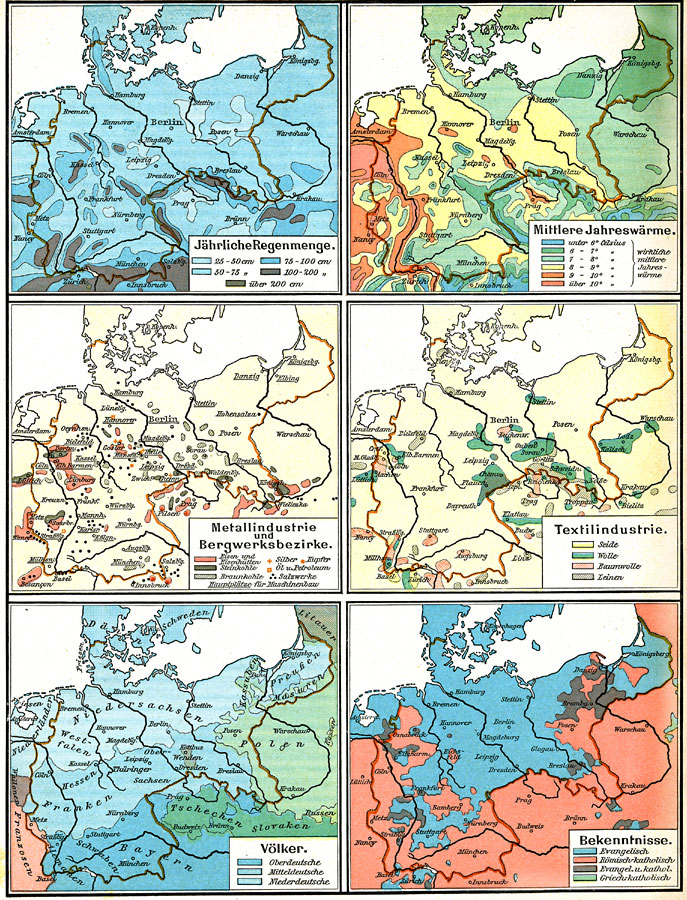
Description: Six maps of the German Empire showing the average rainfall, the major climate zones, metal industrial products and mining (iron, coal, silver, copper, and salt), textile industrial products (silk, wool, cotton, and linen) ethnic groups, and religions.
Place Names: Germany, Berlin, �Bremen, �Cologne, �Dresden, �Frankfurt am Main, �Hamburg, �Hannover, �Mannheim, �Nuremberg, �Wiesbade
ISO Topic Categories: climatologyMeteorologyAtmosphere,
economy,
environment,
society
Keywords: Physical and Cultural Geography of the German Empire, physical, �statistical, physical features, agriculture,
industry,
ethnological, climatologyMeteorologyAtmosphere,
economy,
environment,
society, Unknown, 1915
Source: C. Diercke, Lange-Diercke Volksschulatlas (Berlin, : George Westermann, 1915) 40
Map Credit: Courtesy the private collection of Roy Winkelman |
|