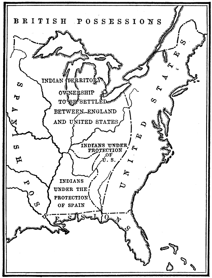
Description: The division of North American territories as proposed by the French Count of Vergennes.
Place Names: A Regional Map of North America, Canada, �United State
ISO Topic Categories: location,
inlandWaters,
oceans,
boundaries
Keywords: Disposition of American Territory proposed by Vergennes, historical, �location, �physical, �political, physical features, major political subdivisions, historical event,
American Revolution, location,
inlandWaters,
oceans,
boundaries, Unknown, 1781–1782
Source: Nathaniel Wright Stephenson, An American History (Boston, MA: Ginn and Company, 1913) 210
Map Credit: Courtesy the private collection of Roy Winkelman |
|