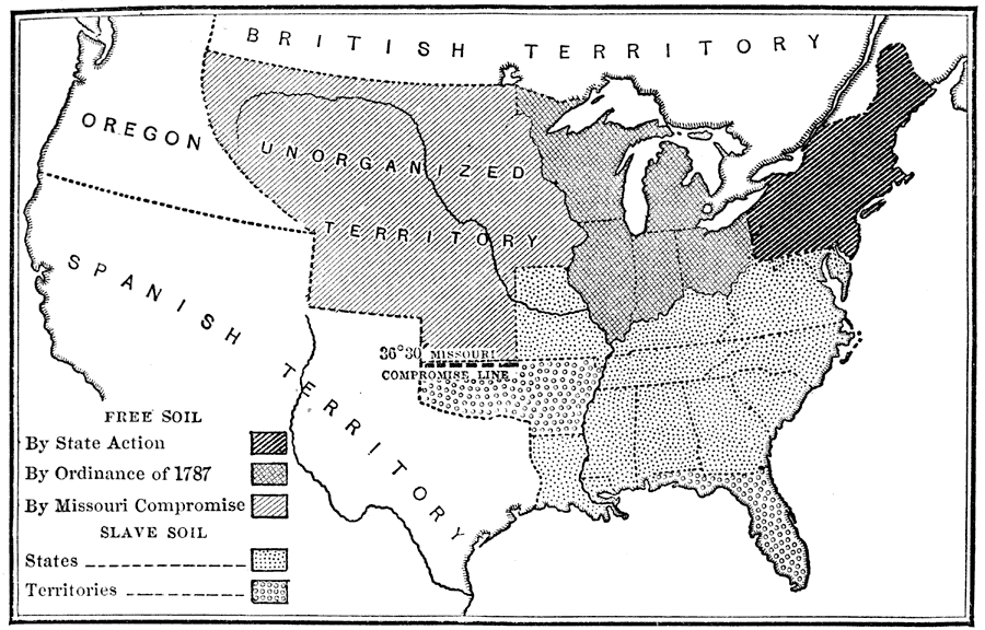
Description: A map of the United States at the time of the Missouri Compromise of 1820. The map is keyed to show the free states by State Action, the free Northwest Territory by the Ordinance of 1787, the free territory north of the Compromise Line, the slave holding states, the slave holding territories, and shows the Missouri Compromise Line at latitude 30°30’ N.
Place Names: Growth of Nation, free states, �slave states, �slavery, �Missouri Compromise, �Ordinance of 178
ISO Topic Categories: location,
inlandWaters,
oceans,
boundaries
Keywords: The Missouri Compromise, historical, �location, �physical, �political, physical features, local jurisdictions, historical event, location,
inlandWaters,
oceans,
boundaries, Unknown, 1820
Source: Nathaniel Wright Stephenson, An American History (Boston, MA: Ginn and Company, 1913) 301
Map Credit: Courtesy the private collection of Roy Winkelman |
|