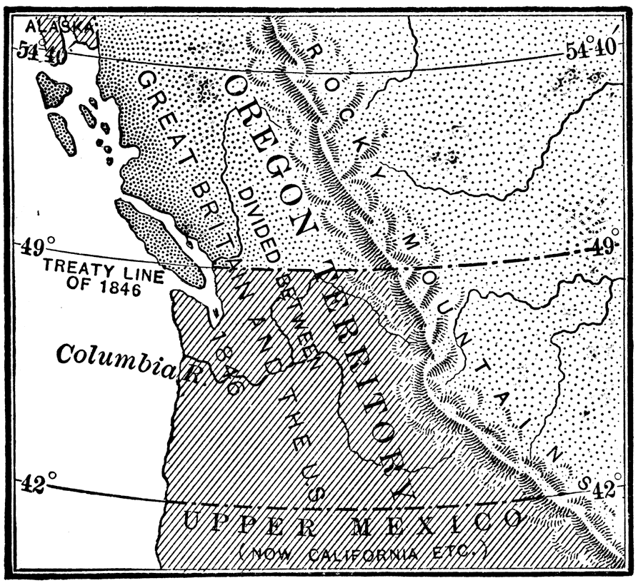
Description: A map of the Oregon Territory showing the boundary on the 49th Parallel established by treaty between Great Britain and the United States in 1846, dividing what was once jointly held territory. The map also shows the boundary with Upper Mexico.
Place Names: Growth of Nation, California, �Idaho, �Oregon, �Rocky Mountains, �Washington, ��Oregon Countr
ISO Topic Categories: location,
inlandWaters,
oceans,
boundaries
Keywords: The Oregon Country, historical, �physical, �political, physical features, major political subdivisions, historical event, location,
inlandWaters,
oceans,
boundaries, Unknown, 1846
Source: Nathaniel Wright Stephenson, An American History (Boston, MA: Ginn and Company, 1913) 356
Map Credit: Courtesy the private collection of Roy Winkelman |
|