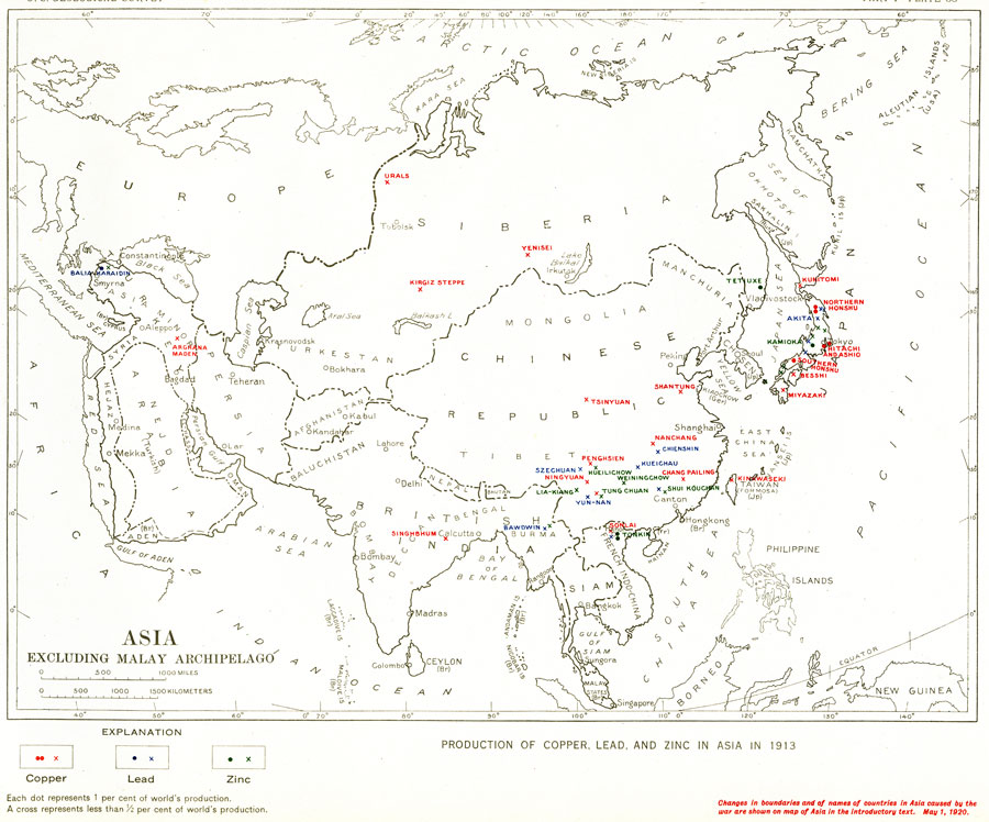
Description: "Production of copper, lead, and zinc in Asia in 1913...Each dot represents 1 per cent of world's production. A cross represents less than 1/2 per cent of world's production ...Changes in boundaries and of names of countries in Asia caused by the war are shown on map of Asia in the introductory text. May 1, 1920." — Department of the Interior, 1921
Place Names: A Complete Map of Asia, China, �India, �Japan, �Mongolia, �Philippines, �Siam, �French Indo-China, �Baluchistan, �Persia, �Siberia,
ISO Topic Categories: boundaries,
economy,
inlandWaters,
oceans
Keywords: Production of Copper, Lead, and Zinc in Asia Excluding Malay Archipelago, physical, �political, �statistical, physical features,
geological, country borders, industry,
economic, boundaries,
economy,
inlandWaters,
oceans, Unknown, 1913
Source: Department of the Interior , World Atlas of Commercial Geology (Washington, DC: Department of the Interior , 1921) Plate 38
Map Credit: Courtesy the private collection of Roy Winkelman |
|