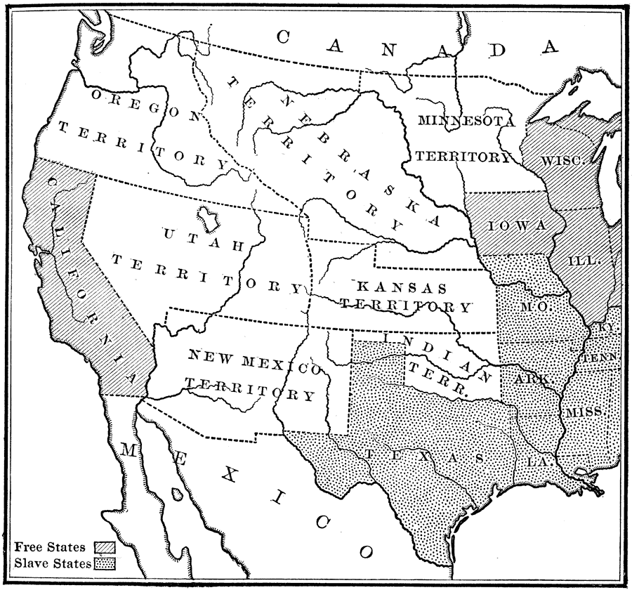
Description: Shows western territories in United States, and is shaded to distinguish between free and slave states.
Place Names: Western States, Arkansas, �Illinois, �Iowa, �Kentucky, �Louisiana, �Maryland, �Minnesota, �Mississippi, �Missouri, �New Mexico, �Tennessee, �Texas, �Utah, �Washington, �Wisconsi
ISO Topic Categories: location,
inlandWaters,
oceans,
boundaries
Keywords: Our Western Territories, historical, �physical, �slavery, physical features, historical event, location,
inlandWaters,
oceans,
boundaries, Unknown, 1854
Source: Nathaniel Wright Stephenson, An American History (Boston, MA: Ginn and Company, 1913) 391
Map Credit: Courtesy the private collection of Roy Winkelman |
|
