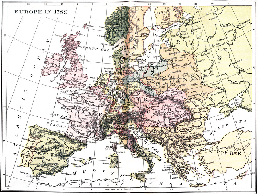
Description: A map of Europe at the onset of the French Revolution. "What was Europe in 1789? One thing, at least, it was not: it was not a unity. There were states of every size and shape and with every form of government. The States of the Church were theocratic; capricious and cruel despotism prevailed in Turkey; absolute monarchy in Russia, Austria, France, Prussia; constitutional monarchy in England; while there were various kinds of so–called republics – federal republics in Holland and Switzerland, a republic whose head was an elective king in Poland, aristocratic republics in Venice, Genoa and the free cities of the Holy Roman Empire." — Hazen, 1917
Place Names: Western and Central Europe, France, �Germany, �Italy, �Greece, �Poland, �Portugal, �Spain, �Sweden, �Norway, �Prussia, �German Empire, �State of the Church, �Russia, �Switzerland, �Kingdom of Sardinia, �Kingdom of Naples, �England, �Venice, �Genoa, �Holy Roman Empire,
ISO Topic Categories: boundaries,
inlandWaters,
oceans,
society
Keywords: Europe, physical, �political, �historical, physical features,
topographical, country borders,
major political subdivisions, historical event, boundaries,
inlandWaters,
oceans,
society, Unknown, 1789
Source: Charles Downer Hazen, The French Revolution and Napoleon (New York, NY: Henry Holt and Company, 1917) Frontpiece
Map Credit: Courtesy the private collection of Roy Winkelman |
|
