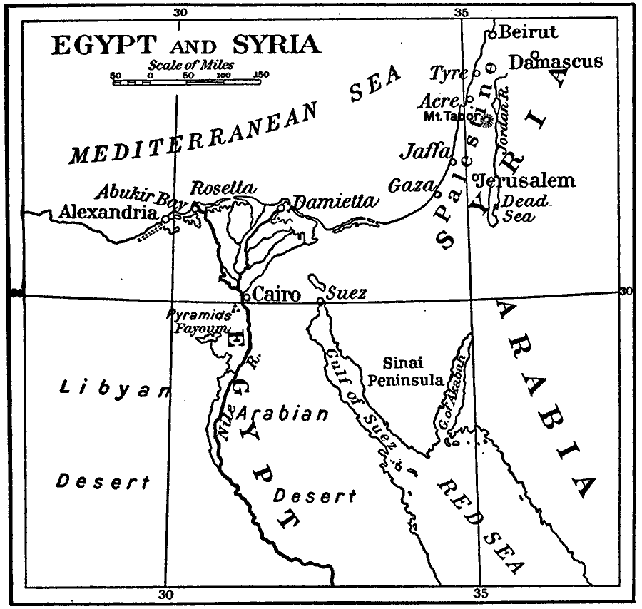
Description: "Seizing Alexandria on July 2 the French army began the march to Cairo...There Bonaparte administered a smashing defeat to the Mamelukes, encouraging his soldiers by one of his thrilling phrases, 'Soldiers, from the summit of these pyramids forty centuries look down upon you.' The Battle of the Pyramids, July 21, 1798, gave the French control of Cairo...Hearing that the Sultan of Turkey had declared war on him, he [Bonaparte] resolved in January, 1799, to invade Syria, one of the Sultan's provinces, wishing to restore or reaffirm the confidence of his soldiers by fresh victories and thinking, perhaps, of a march on India or on Constantinople, taking 'Europe in the rear,' as he expressed it...[Bonaparte] seized the forts of Gaza and Jaffa, and destroyed a Turkish army at Mt. Tabor, near Nazareth, but [was] arrested at Acre, which [he] could not take by siege, because it was on the seacoast and was aided by the British fleet..." — Hazen, 1917
Place Names: A Regional Map of Africa, Egypt, �Syria, �Cairo, �Gulf of Suez, �Abukir, �Jaffa, �Gaza, �Mt. Tabor, �Acre, �Damascus, �Alexandria, �Nile Rive
ISO Topic Categories: inlandWaters
Keywords: Egypt and Syria during Bonaparte's Egypt Campaign, physical, �historical, physical features, inlandWaters, Unknown, 1798–1801
Source: Charles Downer Hazen, The French Revolution and Napoleon (New York, NY: Henry Holt and Company, 1917) 257
Map Credit: Courtesy the private collection of Roy Winkelman |
|
