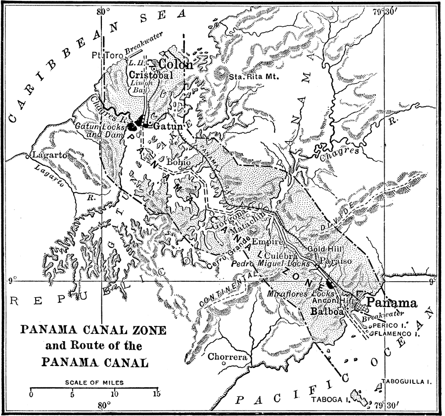
Description: The Panama Canal Zone and route of the Panama Canal. The Panama Railroad line between Colon and Panama City is shown, as well as he Gantun locks, Pedro Miguel locks, and the Miraflores locks. Natural features include Limon Bay, Gatun Lake, and the continental divide.
Place Names: Panama Canal Zone, Colon, �Cristobal, �Panama, �Pt. Toro, �Gatun, �Chagres River, �Continental Divide, �Balboa,
ISO Topic Categories: boundaries,
inlandWaters,
oceans,
transportation
Keywords: Panama Canal Zone, physical, �political, �transportation, physical features,
topographical, local jurisdictions, water routes,
railroads, boundaries,
inlandWaters,
oceans,
transportation, Unknown, 1915
Source: Frank G. Carpenter, Carpenter's Geographical Reader: South America (New York, NY: American Book Company, 1915) 18
Map Credit: Courtesy the private collection of Roy Winkelman |
|