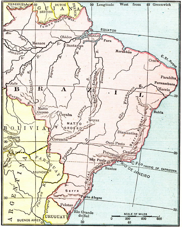
Description: Map of Brazil showing boundaries current to 1915, major cities, rivers, Amazon River basin, the Matto Grosso, and the coastal mountain systems south of Bahia. Portions of Venezuela, the Guianas, Bolivia, Paraguay, Argentina, and Uraguay are also shown. "What an immense country Brazil is! It is hard for us to realize its extent. The states which look so small on the map widen out as we travel over them, and we are struck with the fact that we are in one of the largest countries of the world. There are only four other nation which own so much land as the Brazilians. Their republic is larger than the whole United States, without Alaska and our outlying islands. It is longer from north to south than the distance from Pittsburg to San Francisco, and its width from east to west is greater than the distance from New York to Salt Lake City. It contains more than 3,228,000 square miles, almost half of all the land of South America." — Carpenter, 1915
Place Names: Brazil, Maceio, �Manaus, �Porto Alegre, �Sao Paulo, �Matto Grosso, �Rio Grande do Sul, �Rio de Janeiro, �Petropolis, �Bahia, �Para, �Rio Negro, �Amazon River, �Madeira River, �Serra do Mar, �Serra Aymore, �Tumac Humac Mountain
ISO Topic Categories: boundaries,
inlandWaters,
oceans
Keywords: Brazil, physical, �political, �Equator, �Tropic of Capricorn, �physical features,
topographical, country borders, boundaries,
inlandWaters,
oceans, Unknown, 1915
Source: Frank G. Carpenter, Carpenter's Geographical Reader: South America (New York, NY: American Book Company, 1915) 242
Map Credit: Courtesy the private collection of Roy Winkelman |
|
