| Maps > Europe > Austria |
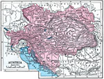 |
Austria, 1872 Physical map of Austria. |
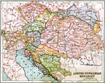 |
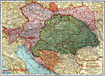
Austro-Hungarian Monarchy, 1883 Physical map of Austro-Hungarian Monarchy. |
 |
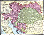
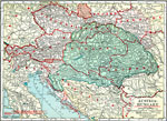
Austria-Hungary, 1904 Map of Austria-Hungary. |
 |
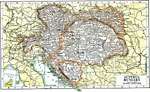
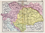
Austro-Hungarian Monarchy, 1906 Map of Austro-Hungarian Monarchy in 1906. |
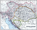 |
Austria-Hungary, 1910 Map shows Austria-Hungary. |
 |
Austria-Hungary, 1920 Austria-Hungary, showing railroads, canals, and submarine telegraph lines. Also shows "conjectural boundaries drawn along ethnographical lines with soverignty to be decided by plebiscite."—Leslie's New World Atlas, 1920 |
 |
Austria-Hungary, 1920 Physical map of Austria-Hungary with both old and new boundaries. Includes railroads, canals, and submarine telegraph lines. |
 |
Austria-Hungary, 1920 Map of Austria-Hungary. |
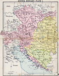 |
Austria-Hungary Plate I, 1920 First in a series of regional maps of Austria-Hungary. |
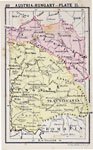 |
Austria-Hungary Plate II, 1920 Second in a series of regional maps of Austria-Hungary. |
| Maps > Europe > Austria |
Maps is a part of the Educational Technology Clearinghouse
Produced by the Florida Center for Instructional Technology © 2007
College of Education, University of South Florida