| Maps > United States > Colorado |
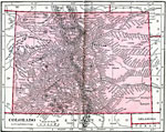 | Colorado, Map of Colorado in 1906. |
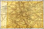
 | Colorado, A map of Colorado in 1919, showing railways and towns. |
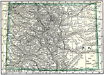
 | Colorado, A map of Colorado in 1891. |
 | Colorado Range, A map showing the cross folds on the eastern border of Colorado Range. |
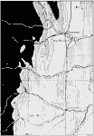
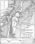 | Colorado Valley, A map of part of the Colorado Valley, showing an old gravel-filled channel on the right and a rock channel on the left. |
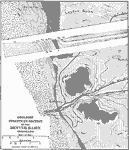 | Denver Basin, A map showing the geologic structure section of the Denver Basin. |
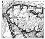
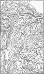 | Georgetown District, A map showing the present topography of the Georgetown district Colorado. |
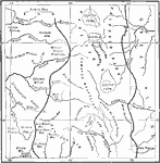
 | Glacier systems in Leadville, A map showing the extent of the former glacier systems in parts of the Park (east) and the Sawatch (west) ranges of Colorado, Leadville quadrangle. |
 | Mesa de Maya, A map of topography of Mesa de Maya, south-central Colorado. Typical lava-capped mesa with steep bordering scarps and Flattish summit. |
 | Southern Rockies, A location map of the southern Rockies. |
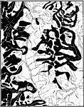
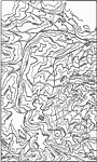 | Upland Restored, A map showing the old mountainous upland of the Georgetown district. |
| Maps > United States > Colorado |
Maps is a part of the Educational Technology Clearinghouse
Produced by the Florida Center for Instructional Technology © 2007
College of Education, University of South Florida